Monday, December 15, 2008

100 (geologic) things meme

Looks like another fun meme going around the geoblogosphere. Let's see how I score... (Things I've done are in bold, and my comments are in italics.)

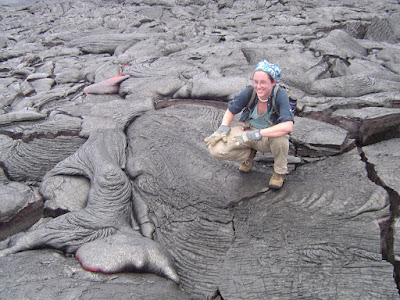
1. See an erupting volcano
2. See a glacier
3. See an active geyser such as those in Yellowstone, New Zealand or the type locality of Iceland
4. Visit the Cretaceous/Tertiary (KT) Boundary. Possible locations include Gubbio, Italy, Stevns Klint, Denmark, the Red Deer River Valley near Drumheller, Alberta. - I've sat on it - or at least very close to it - in Big Bend National Park. See the Ks and Ts? Yeah, we were all dorks.

5. Observe (from a safe distance) a river whose discharge is above bankful stage - The Potomac flooded a few neighborhoods near my family's house when Hurricane Isabel came through.
6. Explore a limestone cave. Try Carlsbad Caverns in New Mexico, Lehman Caves in Great Basin National Park, or the caves of Kentucky or TAG (Tennessee, Alabama, and Georgia) - I've made it to Carlsbad, Mammoth Caves and various small ones in Virginia.
7. Tour an open pit mine, such as those in Butte, Montana, Bingham Canyon, Utah, Summitville, Colorado, Globe or Morenci, Arizona, or Chuquicamata, Chile.
8. Explore a subsurface mine.
9. See an ophiolite, such as the ophiolite complex in Oman or the Troodos complex on the Island Cyprus (if on a budget, try the Coast Ranges or Klamath Mountains of California).
10. An anorthosite complex, such as those in Labrador, the Adirondacks, and Niger (there's some anorthosite in southern California too).
11. A slot canyon. Many of these amazing canyons are less than 3 feet wide and over 100 feet deep. They reside on the Colorado Plateau. Among the best are Antelope Canyon, Brimstone Canyon, Spooky Gulch and the Round Valley Draw. - Lots of these in various places out West.

12. Varves, whether you see the type section in Sweden or examples elsewhere.
13. An exfoliation dome, such as those in the Sierra Nevada.
14. A layered igneous intrusion, such as the Stillwater complex in Montana or the Skaergaard Complex in Eastern Greenland.
15. Coastlines along the leading and trailing edge of a tectonic plate (check out The Dynamic Earth - The Story of Plate Tectonics - an excellent website).
16. A ginkgo tree, which is the lone survivor of an ancient group of softwoods that covered much of the Northern Hemisphere in the Mesozoic.
17. Living and fossilized stromatolites (Glacier National Park is a great place to see fossil stromatolites, while Shark Bay in Australia is the place to see living ones) I can only claim half of this one, but I saw some fantastic stromatolites on the Niagara Escarpment near Lockport.

18. A field of glacial erratics
19. A caldera

20. A sand dune more than 200 feet high
21. A fjord
22. A recently formed fault scarp - Wait, define "recently" - we're geologists, after all. Recently could mean a few million years ago.
23. A megabreccia
24. An actively accreting river delta
25. A natural bridge
26. A large sinkhole
27. A glacial outwash plain
28. A sea stack
29. A house-sized glacial erratic
30. An underground lake or river
31. The continental divide

32. Fluorescent and phosphorescent minerals
33. Petrified trees - At Petrified Forest National Park, where you get in serious trouble just for touching one, and about five minutes outside the park, where no one cares.

34. Lava tubes

35. The Grand Canyon. All the way down. And back. I wasn't in good enough shape to make it all the way down and back in one day, like some crazy people on that trip did, but I have seen it from the South and North Rims, so I'm counting it. :P
36. Meteor Crater, Arizona, also known as the Barringer Crater, to see an impact crater on a scale that is comprehensible (and it is quite BIG)
37. The Great Barrier Reef, northeastern Australia, to see the largest coral reef in the world.
38. The Bay of Fundy, New Brunswick and Nova Scotia, Canada, to see the highest tides in the world (up to 16m)
39. The Waterpocket Fold, Utah, to see well exposed folds on a massive scale.
40. The Banded Iron Formation, Michigan, to better appreciate the air you breathe.
41. The Snows of Kilimanjaro, Tanzania,
42. Lake Baikal, Siberia, to see the deepest lake in the world (1,620 m) with 20 percent of the Earth's fresh water.
43. Ayers Rock (known now by the Aboriginal name of Uluru), Australia. This inselberg of nearly vertical Precambrian strata is about 2.5 kilometers long and more than 350 meters high
44. Devil's Tower, northeastern Wyoming, to see a classic example of columnar jointing
45. The Alps.
46. Telescope Peak, in Death Valley National Park. From this spectacular summit you can look down onto the floor of Death Valley - 11,330 feet below.
47. The Li River, China, to see the fantastic tower karst that appears in much Chinese art
48. The Dalmation Coast of Croatia, to see the original Karst.
49. The Gorge of Bhagirathi, one of the sacred headwaters of the Ganges, in the Indian Himalayas, where the river flows from an ice tunnel beneath the Gangatori Glacier into a deep gorge.
50. The Goosenecks of the San Juan River, Utah, an impressive series of entrenched meanders.
51. Shiprock, New Mexico, to see a large volcanic neck - Even if the van was traveling 60 mph at the time, I still saw it!

52. Land's End, Cornwall, Great Britain, for fractured granites that have feldspar crystals bigger than your fist.
53. Tierra del Fuego, Chile and Argentina, to see the Straights of Magellan and the southernmost tip of South America.
54. Mount St. Helens, Washington, to see the results of recent explosive volcanism. - Maybe this summer!
55. The Giant's Causeway and the Antrim Plateau, Northern Ireland, to see polygonally fractured basaltic flows.
56. The Great Rift Valley in Africa.
57. The Matterhorn, along the Swiss/Italian border, to see the classic "horn".
58. The Carolina Bays, along the Carolinian and Georgian coastal plain
59. The Mima Mounds near Olympia, Washington
60. Siccar Point, Berwickshire, Scotland, where James Hutton (the "father" of modern geology) observed the classic unconformity
61. The moving rocks of Racetrack Playa in Death Valley
62. Yosemite Valley
63. Landscape Arch (or Delicate Arch) in Utah
64. The Burgess Shale in British Columbia - Only the display at the Smithsonian.
65. The Channeled Scablands of central Washington
66. Bryce Canyon
67. Grand Prismatic Spring at Yellowstone
68. Monument Valley
69. The San Andreas fault
70. The dinosaur footprints in La Rioja, Spain
71. The volcanic landscapes of the Canary Islands
72. The Pyrennees Mountains
73. The Lime Caves at Karamea on the West Coast of New Zealand
74. Denali (an orogeny in progress)
75. A catastrophic mass wasting event - Only after the fact, in Utah and the Virginia Blue Ridge.
76. The giant crossbeds visible at Zion National Park
77. The black sand beaches in Hawaii (or the green sand-olivine beaches) - Both, baby!
78. Barton Springs in Texas
79. Hells Canyon in Idaho
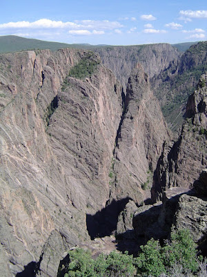
80. The Black Canyon of the Gunnison in Colorado
81. The Tunguska Impact site in Siberia
82. Feel an earthquake with a magnitude greater than 5.0.
83. Find dinosaur footprints in situ
84. Find a trilobite (or a dinosaur bone or any other fossil)
85. Find gold, however small the flake
86. Find a meteorite fragment
87. Experience a volcanic ashfall - Just wait until March!
88. Experience a sandstorm
89. See a tsunami
90. Witness a total solar eclipse
91. Witness a tornado firsthand - I'm pretty sure there was a brief and minor one near our house when I was really little, but we were too busy cowering in the basement to see it.
92. Witness a meteor storm, a term used to describe a particularly intense (1000+ per minute) meteor shower
93. View Saturn and its moons through a respectable telescope. - Does it automatically become respectable if it's most of the way up Mauna Kea?
94. See the Aurora borealis, otherwise known as the northern lights.
95. View a great naked-eye comet, an opportunity which occurs only a few times per century - Hale-Bopp, when I was twelve. Gee, I feel awfully young.
96. See a lunar eclipse - Quite a few of these in the past few years, actually.
97. View a distant galaxy through a large telescope
98. Experience a hurricane - Just a few years ago, in Florida. Weak hurricanes are boring - I think my flight was delayed and I spent the day at the mall.
99. See noctilucent clouds
100. See the green flash

26 out of 100. Well, I certainly don't measure up to most of you all in the geoblogosphere, but I'm still a young'un yet. Besides, I'll be fixing that ash fall and earthquake deficiency when I get to do field work in a couple of months. In fact, my dearth of bolded items is clearly unacceptable, and I'm just going to take a few years and go visit all these places* so I can update this post.

*This, of course, requires money, which I do not have in large amounts. So those few years aren't going to happen anytime soon, darn it.

Saturday, December 6, 2008

The Fish Lake Plateau: "A most eligible summer camping-place" (Accretionary Wedge #14/15)

I haven't done a whole lot of research yet, but I always enjoy a good chance to get out in the field. For my undergraduate thesis, this meant spending a few weeks in south-central Utah, on the High Plateaus. The work was part of the 2006 NSF Fish Lake Research Experience for Undergraduates, a joint effort between the College of William & Mary and Coastal Carolina University. The project was in its second year, and had been inspired by past W&M field trips to Fish Lake.

My first visit to Fish Lake was on one of those trips - I had just finished my freshman year, and I was still struggling to learn all the basic skills of field mapping. As I remember, we had a discussion about whether Fish Lake was formed by glacial or tectonic processes (and I was on the glacial side, which ended up being not a great choice). Shortly after that, however, my advisor mentioned that the REU would be doing research there, and (dropping a blatant hint to get me interested) that there might be some volcanology I could work on.

So, in the summer of my junior year, I helped drive a minivan full of equipment from the East Coast to Utah. With three people rotating through, and not stopping other than for gas and food, we made it there in about 40 hours. (The rest of the group flew to Salt Lake City and drove from there, but at least they left us a couple of days to recover.) The three weeks that followed were an amazing, challenging, and at times frustrating experience, but I couldn't have picked a more fascinating place to spend them.

The Fish Lake Plateau has something for everyone*: Mesozoic sedimentary rocks,

Tertiary volcanics,

forest,

desert,

faults,

cirques,

landslides,

and scads of Quaternary sedimentary deposits.

It has been a geologist's playground since Clarence Edward Dutton's expedition reached it in the 1880s, and since my brain is a bit fried from studying for finals, I'll let him do a little of the describing for me:
"...we may look down upon the beautiful surface of Fish Lake. This sheet of water, about 5 1/2 miles in length and a mile and a half in breadth, is walled in by two noble palisades..."
"Not the smallest among its attractions for the geologist is the fact that it is a most eligible summer camping-place. In the daytime, throughout July, August, and most of September, it is mild and genial, while the nights are frosty and conducive to rest. The grass is long, luxurient, and aglow with flowers."
"Clumps of spruce and aspen furnish shade from the keen rays of the sun, and fuel is in abundance for camp-fires."
"Thus the great requisites for Western camp-life, fuel, water, and grass, are richly supplied, while neither in in such excess as to be an obstacle to progress and examination.
"On every side it is bounded by precipitous cliffs, except along a part of its southwestern flank, but here and there the malls are broken and notched. Along the side facing west-northwest runs a cliff of vast proportions, second only to the western front of the Sevier Plateau in magnitude and grandeur. Upon the very brink of this wall is the highest point of the plateau, from which, in a clear day, we may easily discern the peaks of the Wasatch around Salt Lake City and beyond."
"Upon the east side rise two conspicuous masses - Mount Terril and Mount Marvine."

"No resort more beautiful than this lake can be found in Southern Utah. Its grassy banks clad with groves of spruce and aspen; the splendid vista down between its mountain walls, with the massive fronts of Mounts Marvine and Hilgard in the distance; the crystal-clear expanse of the lake itself, combine to form a scene of beauty rarely equaled in the West."

*As far as it concerns me, however, Fish Lake has no fish. Or, rather, it has fish, but they didn't want to be caught by me - not even after two days of fishing attempts. So much for that 4th of July fish fry we had planned.

Thursday, December 4, 2008

A Big Island Geology Tour

Callan suggested that I post the advice I gave him for his recent trip to Hawaii, and since I haven't had time to write anything really meaningful lately (darn you, end-of-semester crunch time!) I think I'll do just that. You can follow along with his fantastic photos and discussion of the locations he visited - I'll link to each of his blog entries as they go up. (Those links are bold.)

These notes are the result of two trips to the Big Island, one that I made for an undergraduate field course, and one for a vacation and to take the Center for the Study of Active Volcanoes (CSAV) Field Methods in Volcanology class. (I highly reccommend that - where better to train to be a volcanologist than on an active volcano?) In addition, I've put all of these locations and some notes on a Google Map, and some of my own photos here. Enjoy!


View Larger Map


Kona area:
  • About two miles south of Kona on Alii drive is the best snorkeling beach I've been to. It's a public park whose name escapes me, but it's a right turn off Alii before you get to Royal Poinciana Drive. They have snorkel gear rentals, so you don't have to bring your own, and it's an awesome place to see all sorts of fish and sea turtles, which come right up to the beach.
  • Two miles north of the Kona Airport on Rt. 19 is the 1801 Kaupulehu lava flow on the Hualalai volcano. If you're coming from the airport, a large lava tube entrance will be visible on the right side of the road. This is a fantastic exposure of mantle xenoliths - really big chunks of dunite and (I think) websterite - and you can hike a short distance into the lava tube.


Southern Big Island:
  • In addition to the green sand (Mahana or Papalakoa) beach, you should definitely try to get to South Point (Ka Lae), the southernmost point in the US. The cliffs make for a great view, and there's a sea cave to look into. (Some people jump into this thing, which I think is nuts.)


  • The Punaluu Black Sand Beach is another great place for sea turtles, although the waves are too rough for much snorkeling; there is also a resident population of scruffy stray kittens. I also highly recommend stopping at the Punaluu Bake Shop in Na'alehu for some malasadas (Portuguese doughnuts) and lunch.


Hawaii Volcanoes National Park:
  • I don't know if they're letting people near Halemaumau Crater anymore, but if you can get down there, on the other side of Crater Rim Drive from the overlook is the Halemaumau trail, which is a great place to see ballistic blocks from the 1920s eruptions, as well as an old airfield that got plowed up when the Japanese attacked in WWII.
  • The Kilauea Iki hike is a great way to see the crater from the bottom, and you can look into the vent of a fire fountain that erupted in the 60s.

  • If you can hike the caldera, there are great spatter ramparts along the Halemaumau trail.
  • Devastation Trail, which runs behind Pu'u Pu'ai (the cone that formed from the Kilauea Iki eruptions) is a good place to look for Pele's tears, and get a good look at local flora and fauna (we saw lots of birds along here, and the ohia trees and ohelo bushes are pretty common). You can eat ohelo berries along the way, if you want - they get dark red when they're ripe, and make delicious jam. (Be sure to leave an offering for Pele to say thanks, though - she's kind of a touchy goddess.)

  • Thurston Lava Tube is definitely worth a visit, and if you bring a headlamp (a good one, and maybe an extra flashlight), you can hike all the way to the back of the unlit section, where most of the tourists don't go.
  • Along Chain of Craters Road, before you get to the active flow fields, there's an overlook and parking area next to a collapsed lava tube. If you follow the tube over the flow fields to the north, it leads all the way back to the summit of Mauna Ulu. (It's a long hike and you either have to go back the same way or have someone meet you along one of the other roads afterwards, though, and sometimes the access roads are closed.)
Hilo:
  • Coconut Island in Hilo Bay has records of tsunami inundation heights posted on trees; it's also a good lunch and swimming spot.
  • The Boiling Pots are a neat series of waterfalls and plunge pools that the locals go to for swimming (and for launching themselves off of cliffs). There's a public parking area and picnic tables, but this is a good place to keep a close eye on your stuff. (Be careful to stay out of people's backyards, too, because some of them grow marijuana and they're a bit touchy about trespassers...)

Mauna Kea:
  • Definitely drive up to the summit. It's probably best to do this from the Hilo side, since there are no gas stations in the center of the island and you'll need a full tank to get up and down. There's an unpaved stretch of road between the ranger station at 9000 feet and the summit (13,000 feet) which is pretty grueling, but it's worth the drive if you take your time. When you get to the observatories at the summit, be sure to hop over the railing and climb the small cinder cone with the shrine on top - that's the real summit, and where you'll find the Mauna Kea benchmark. Be sure to spend at least an hour at the ranger station, though, and chug a few nalgenes of water before you try to go to the top - you'll be less likely to get altitude sickness. It's also a great place to see silversword plants, which are very rare.


  • The ranger station has astronomy sessions in the evenings where students from UH Hilo help set up telescopes for moon and planet viewing. It gets extremely cold, but they sell coffee and tea and ramen that you can heat up in their microwave.
  • Below the summit of Mauna Kea, around mile 6 of the access road, there's a small pulloff (on the right as you're driving up). If you hike out a bit over the scoria, there are some flat-topped rocks. Have a look at the top of these - this is the closest point one of the closest points to the equator that you can find evidence of glaciation! There are glacial striations here, and the debris surrounding the outcrop is supposed to be remnants of a glacial moraine. (There are a lot of glacial features up there, but I didn't get to see them all - the rangers will probably be able to steer you to them.)


Kohala Coast:
  • Laupahoehoe Beach Park has a monument to the people who were killed in the 1946 tsunami. It's a beatiful place to camp, and they've installed tsunami warning sirens since the 40s.
  • Waipio valley is absolutely worth the climb down the ridiculously steep road to get to the beach - some people will drive down, but I'd recommend not risking a rental car on it. Great saprolite exposures at the top of the road. If you make it to the far end of the beach (it takes a little stream-fording), you can see cliffs that expose a number of the lava flows that make up the ancient Kohala volcano. There are also boulders of some really funky lavas here; we found one piece that was chock full of huge plagioclase phenocrysts. Watch out for the donkeys that live in the area - they bite - and pay attention to the "kapu" signs; this used to be a burial ground for Hawaiian kings. I wouldn't recommend much swimming - the surf is very rough and the area is known for sharks.


Other:
  • Off Rt. 137 (Kapoho-Kalapana Rd), which you have to approach from the east or north (since the current flow field took out the ocean road), there is a black sand beach and breadfruit/palm tree molds. This is the remains of the Kalapana Gardens subdivision; the people who still live there planted hundreds of coconut palms along the newly formed beach here.
  • On Rt. 250 (Kohala Mountain/Hawi Road) north of Waimea (the north end of the island), there's a lava dome of benmoreite associated with late-stage, secondary melts from the Kohala volcano. I'm not sure of the exact location, but it's a light-colored roadcut with a bit of an overlook down on the Waimea valley. The benmoreite is probably one of the most felsic rocks on the island, so it's a bit of a novelty. (There are other benmoreites on Mauna Kea, but this is the only one I've seen.) *Sadly, I don't have a photo of the outcrop, but this website does.
For those of you who want more detailed geological descriptions than I've been providing, the USGS has some good Open-File geologic maps of the islands, and Hawaii Volcanoes National Park sells more detailed ones (as well as topo maps with trails marked).

A few safety reminders:
If you're going out hiking on the lava fields (or anywhere else in Hawaii, for that matter), make sure you have the right gear, enough water and lots of sunscreen. Hawaii is much closer to the equator than most people realize, and it is very easy to get dehydrated and sunburned there (a really bad combination). I saw far too many people on both of my visits without proper hiking gear (sturdy shoes, long pants, hats, sunglasses, etc). Thick work gloves are also important for hiking on lava - when you fall, you tend to break your fall with your hands, and believe me, you don't want to grind volcanic glass into them. Also, if you'll be anywhere near hot lava, don't wear thin synthetic clothing. Picking melted nylon off your skin is not a fun exercise, no matter how great your new bug-zapper button-down is. Natural fabrics (cotton and linen) will scorch but not melt.

For a short hike (no more than a mile or two), bring at least two Nalgenes of water. For a long hike, bring a least a gallon - that's at least four Nalgenes. It's heavy, but you'll drink all of it, because it gets darned hot out there. Follow the same rules you would if you were in a desert - there is nowhere on those lava fields to get water, and rainwater that collects in hollows is often filled with nasty microscopic critters. Don't ever go hiking off-trail without an experienced guide, and certainly don't do it in flip flops. (I have seen people do this, and it is truly shocking.)

That said, Hawaii is a truly awesome place to explore, and even better if you do it safely. Watch out for yourselves!

Saturday, November 22, 2008

Taking a volcano's temperature

While running through my RSS feed, I came across this National Geographic article about using thermal infrared imaging to monitor and forecast volcanic eruptions. I'm currently working on a project that involves using satellite imagery to detect and map hydrothermal alteration products in a volcanic dome, so I was definitely interested, especially because the scientists involved are using data from the same instrument that I am.

First, I have to give them props for using the term "forecast" rather than "predict". I know a number of volcanologists who are touchy about using "predict", because any conclusions about what a volcano may or may not do are necessarily based on probabilities, just like a weather forecast. When people start thinking that we can say for certain when a volcano will erupt, we get the blame when it doesn't, and they have to deal with the consequences of precautionary evacuations - or if it erupts sooner and takes everyone by surprise. It's very important that people know that no scientist can be 100% sure when a volcano will erupt and what it will do - voclanoes are simply too complicated.

I also like the bit about volcanologists being "courageous scientists". I suppose that even though we're very aware of the danger involved in our work, we don't really see ourselves as courageous. It's just another aspect of a job, and for the most part a calculated risk when we venture onto an active volcano to observe eruptions. That said, if there are alternative ways to get the same information with less risk of getting injured or killed (or having to spend an inordinate amount of time and effort getting to hard-to-reach places), I'm all for them.

Anyway, the article discusses how Michael Ramsey and Adam Carter of the University of Pittsburgh are using a combination of ASTER (Advanced Spaceborne Thermal Emission and Reflection Radiometer) satellite images and FLIR (Forward-Looking Infrared Radiometer) camera pictures to monitor active volcanoes on the Kamchatka peninsula. This area of Russia is of major concern to both volcanologists and the aviation industry, because there a number of airplane flight routes go directly over this area. Erupting stratovolcanoes can create ash plumes that rise up to 50 km, far above the normal crusing altitute of a jet. The worldwide Volcanic Ash Advisory Centers already keeps a watch on these volcanoes using the MODIS (Moderate Resolution Imaging Spectroradiometer) and TOMS (Total Ozone Mapping Spectrometer). MODIS detects the thermal signatures of eruptions, and TOMS detects the gases - usually SO2 - associated with plumes.

(ASTER image of Bezymianny volcano lava flow from NASA Visible Earth image archive)


Ramsay and Carter (together with U.S. scientists at the University of Alaska-Fairbanks and Russian experts at Kamchatka's Institute of Volcanology and Seismology) worked at Bezymianny volcano, using the FLIR to record temperature increases in the lava dome just days prior to an eruption. They were able to correlate their ground data with data from NASA's ASTER (Advanced Spaceborne Thermal Emission and Reflection Radiometer) instrument, which records several bands of thermal infrared data. This is particularly significant because it means that for volcanoes with fairly well defined thermal precursors to explosive eruptions, scientists can use satellites to monitor them, rather than traveling to remote locations with expensive, cumbersome equipment.

There are a few caveats. Any thermal satellite image records not only the temperature at any one time in a location, but the temperature history. Thermal emissivity varies with the amount of energy a surface absorbs, and with the rate that the surface re-emits that energy. Some surfaces absorb lots of energy but lose it quickly; some absorb energy and emit it slowly; others don't absorb much at all. All of this shows up in a thermal image, which should be treated more as a time exposure than a single snapshot. The article sums it up pretty well:
"Because the satellite images capture an average temperature reading for the entire volcano at a given moment, the scientists knew the reading in some areas was probably many times higher."
This must be taken into account when analyzing satellite data. A single "bright" ASTER image can mean that temperature increased suddenly, or that temperatures increased steadily over the course of hours or even days, depending on how quickly the lava's surface loses heat. Several images, taken hours or days apart, however, would prove very useful. Unfortunately, obtaining even one line of ASTER data - or data from any satellite that records in the thermal band - is expensive, and requires a special requisition process. Additionally, most thermal data comes from instruments on satellites that also serve other purposes; finding a way to dedicate any satellite entirely to recording thermal imagery of volcanoes would be difficult and expensive (again). Still, it would be extremely useful - and it's exciting research even without that.

The research is being partially supported by the National Geographic Society's Committee for Research and Exploration. A Bulletin of Volcanology article about their work can be found here.

Friday, November 14, 2008

Volcanoes in fiction

Volcanoes are a really popular subject for movie-fiction - they're flashy, dangerous, unpredictable (unless you're Pierce Brosnan), and they explode. They're also appealing because moviemakers can, for the most part, get away with really spectacular CGI and not a lot of thought about the processes occurring on the volcano. (Not that they can get past us, but the average moviegoer hasn't had much volcano education beyond the cone-with-a-central-conduit diagram.)

Incorporating volcanoes into fiction, however, is riskier, because you can't just slap CGI onto the page. You have to describe what's happening, and if you have a crappy description, it makes the story less believable and generally lowers the quality of the whole reading experience.

I spend a lot of time reading fiction as well as non-fiction, and I'm always interested when I come across a story that tries to incorporate volcanoes. Here are a few that I've found so far:

Melting Stones by Tamora Pierce (an offshoot of the Circle of Magic series)
These books are meant for younger readers, but I've always found them entertaining - and very well written. This is the latest of the offshoots of a series about young "ambient" mages - people who draw their magical abilities from their environment. Evvy, the main character in Melting Stones, is a stone mage, and has to deal with a reawakening island volcano. The descriptions of eruption precursors - acidified water, sustained earthquakes, poisonous gases - are spot on, and it's really neat the way Tamora Pierce describes the forces at work within a volcano as if they were sentient beings. A good book if you like fantasy and realistic alternative worlds, and especially if you like strong female characters (a staple of Pierce's writing, and one of the reasons I enjoy her books so much).

Dark of the Sun by Chelsea Quinn Yarbro

The Saint-Germain vampire (yes, vampire) series by Chelsea Quinn Yarbro are fabulous and very well researched works of historical fiction. Yarbro gets to move her main character, who is a vampire (and thus immortal) through many periods in history, and in this book he lives through the 416 AD eruption of Krakatau. It's a fascinating book because you get to read how people might have reacted to a major eruption and its subsequent (very bad) climatic effects. Saint-Germain is forced to give up his merchant trade in China and move west; many of the people he encounters along the way think it's the end of the world, and rightly so, since their crops and animals die, diseases run rampant, and life just generally goes downhill fast. It's fortuitous for Saint-Germain because the ash in the atmosphere relieves some of the detrimental effects he suffers from exposure to sunlight - apparently volcanoes and vampires go very well together! The characters and writing can get a bit prosy sometimes, but the characters are complex and believable and you learn a lot about the cultures/time periods that they live in. (Right down to languages and clothing styles; really, Yarbro does so much preliminary research for these books that she could probably write a nonfiction companion text.)

Journey to the Center of the Earth by Jules Verne

The ultimate in geologic fiction. Volcanoes come into the story at both its beginning and its end; they are the route by which the travelers enter and exit Verne's subterranean world. I'm especially fond of the French version, since it's the original and nuances are often lost in translation (or obliterated entirely by clumsy adaptation). That said, the volcanoes in the story are not very realistic; even if they managed to get down into the crater of Snaeffels, Prof. Lidenbrock & Co would never have found an open volcanic conduit leading to empty caves and tunnels. For the most part, magma doesn't drain away after a volcano is done erupting - it sits there and solidifies and plugs up the plumbing. Likewise, the exit from Stromboli would not have happened - even providing a wooden raft had been able to withstand superheated water and magma pushing it up a volcanic conduit, one might expect that being blasted out of a volcano might prove problematic. Still, the book is great for depicting the science of geology as Verne knew it, and since no one really knew much about volcanoes at that point, it's interesting to see how he interpreted the facts available to him.


These are just a few things that I've found so far; I'm sure there are many others. What are your favorite works of fiction that include geology - accurate or not? (Book adaptations of movies don't count, and we've already excoriated those enough. Books that were turned into movies do count.)