
Saturday, November 6, 2010
The volcano Gatekeeper
One of the sad - but not unexpected - stories to come from the eruption at Mount Merapi concerns the death of the "Gatekeeper" of the volcano, Mbah Marijan. Marijan was mentioned in a 2008 National Geographic article, "The Gods Must Be Restless", that I blogged about a long time ago - and that has turned out to be depressingly prophetic...
Want to read the rest of this post? Go to Magma Cum Laude's new home at the AGU Blogosphere - and remember to update your links and RSS feeds! This will be the last article crossposted to this site; after today, you will need to go to the new AGU page to follow the blog.
Wednesday, November 3, 2010
Support volcano monitoring and future volcanologists
It's been a while since I wrote about this, and it's definitely time for an update. If you're new to Magma Cum Laude, or just haven't visited the site for a while, you'll notice that there's a "Donate to Santiaguito" tab on the top of the page. Clicking there will help you learn a bit more about a fundraising effort I helped start earlier this year for the Santiaguito Volcano Observatory in Guatemala. For my field research, I spent most of my time either at the Observatory or working with its staff, and realized that although they're in a prime location to collect valuable data about an active volcano, they have very little of the resources and equipment they need...
Want to read more about Earth science fundraising? Check out the rest of this post at Magma Cum Laude's new home on the AGU Blogosphere. Don't forget to update your bookmarks and RSS feeds!
Sunday, October 31, 2010

Saturday, October 30, 2010
Geological Frightfest: The Monolith Monsters

Lee Allison at Arizona Geology deserves credit for inspiring the last movie in the Frightfest series - in his post from June about the Piranha 3D movie, he also mentioned The Monolith Monsters. Again, it's another 1950s movie I haven't had the chance to see, but I'll definitely have to remedy that if I can...guess what's next on the Netflix queue? With a title like that, though, I couldn't resist looking it up. And boy, this one is a doozy. Here's the IMDB summary:
A strange black meteor crashes near the town of San Angelo and litters the countryside with fragments. When a storm exposes these fragments to water, they grow into skyscraper-sized monoliths which then topple and shatter into thousands of pieces that grow into monoliths themselves and repeat the process. Any humans in the way are crushed or turned into human statues. The citizens of San Angelo desperately try to save themselves and the world from the spreading doom.Wikipedia also expands on this with some dirt on some of the main characters, who happen to be geologists (though apparently not very good at on-the-fly rock identification):
In the desert region of San Angelo, California, geologist Ben Gilbert brings a strange black rock back to his office, where he and bored local reporter Martin Cochrane examine it but fail to determine its origin. That night, a strong wind blows a bottle of water over onto the rock, which begins to bubble and smolder. The next day, the head of the geological office, Dave Miller, returns to town from a business trip and finds the office destroyed by a huge growth of black rock and Ben dead, in a rock-hard, apparently petrified state.Things certainly go downhill from there. The rocks spread via the pockets of students on a geology field trip, and pretty soon folks are turning into stone left and right. Not only are the rocks sucking silica out of people, but coming into contact with water allows them to grow and multiply. (Since humans only contain trace amounts of silica, these are obviously not very smart rocks.) The geologists eventually figure out that these are evil outer space rocks, and that salt water (???) will stop their growth. I won't tell you the thrilling conclusion, although it's there in the Wikipedia summary (spoiler alert!) if you want to read it.
This movie is impressive not only for the fact that it has evil space rocks sucking the silica out of people, but for its fantastically corny (and geologically incorrect) dialog. Here are a few gems:
"The desert's full of things that don't belong. Take the salt here. Used to be an ocean bed. Now that ocean knew that the middle of a desert was a pretty silly place for it to be, so it just dried up and went away."Okay, the last one wasn't wrong, but I just had a mental image of a lurking meteor(ite), and it looked something like this:
"You've got to remember, Dave, when this hit our atmosphere, it burned at such a fantastic temperature, that its metal-bearing compounds could have been altered - left ready to activate, to grow!"
"From infinity they come. Meteors! Another strange calling card from the limitless regions of space - its substance unknown, its secrets unexplored. The meteor lies dormant in the night - waiting!"
Watch out, folks. Those space rocks will get you.
Friday, October 29, 2010
Geological Frightfest: El Monstruo de los Volcanes
 Tonight's post will be a short one, because it's Friday and I just spent the last hour carving a pumpkin. This Frightfest offering comes via the suggestion of a devoted reader (thanks, Mom!), and I had to post it, even though I can't find out a lot about the movie. This is the best I could dig up for El Monstruo de los Volcanes: A yeti-like creature with the power to hypnotize its victims stalks the slopes of Mount Popocatepetl, attacking construction workers who are building an inclined railway on the volcano.
Yep, a 1962 horror movie about a volcano yeti. I don't think I can add much to that. (Here's a Spanish website with a short blurb about the movie, for those of you who can read it. Oh, and funicular is another word for an inclined railway, if you get stuck translating it.)
On the volcanic side of things, Volcan Popocatepetl (the name means "smoking mountain" in the Aztec language) is a large stratovolcano about 70 km SE of Mexico City. Its most recent eruption began in January 2005 with a series of phreatic explosions, and has continued since with explosive eruptions of ash and the extrusion of a lava dome. (Check out the GVP's monthly and weekly summaries for more details!)
Thursday, October 28, 2010
Geological Frightfest: Fantasia
 |
| http://en.wikipedia.org/wiki/File:Fantasia-poster-1940.jpg |
I loved Fantasia as a child, and still do - but I have to admit that this sequence was pretty darn scary. (Disney did include it years later in their Halloween Treat TV special, after all - remember that? I used to watch it every year.) Anyway, a quick summary of the animation: In the dead of night, the huge, craggy mountain looming over a small European town becomes the haunt of a huge winged demon and the gathering place of ghosts, ghouls, devils, witches, and all manner of fell creatures. They proceed to have a fiery revel, but are forced back to their lairs by the tolling of church bells.
While the animation is truly imaginative, it's the music that brings me to a geological reference - and the setting that inspired Mussorgsky's title. (Or, rather, Rimsky Korsakov's orchestral arrangement of Mussorgsky's original tone poem St. John's Night on the Bare Mountain.) A bald or bare mountain, in East Slavic (and especially Ukranian) mythology, is a place where witches and other evil creatures gather for their Sabbath. In Ukranian, the term is lysa hora, which is also the name given to many "bald" mountains in Ukraine and Poland. One of the most famous is the Lysa Hora in Kiev, which was supposedly the site of some of the largest witches' gatherings.
This got me to wondering: Why would these hills be bare in the first place? Perhaps there's some geology at work here. In the Blue Ridge mountains, for example, there are a number of spots where the mountaintops are rocky and relatively bare of trees; Old Rag Mountain is topped with granite, and Blackrock Summit with well-cemented quartz sandstone. I was able to find this map of the geology of the USSR (from 1944), but I can't read or type Cyrillic, so it's not much help. Ole Nielsen has a post on kimberlites in the Ukranian Shield which mentions granites, an excellent candidate rock type for bare-topped hills, and possibly what one might find on the summit of a lysa hora. Why would these rocks form bare summits? Well, granite can take an extremely long time to form enough soil to support plant life, especially if it's exposed to transport processes by being at the top of a mountain - and while a sandstone might weather more easily, it needs some organic inputs before it will form anything but...well, sand.
So, it's a good bet that the impressive winged demon in the Fantasia sequence is clinging to something granitic, although the craggy peak in the film is showing just a teensy bit of vertical exaggeration, if you ask me.
The move has finally happened!

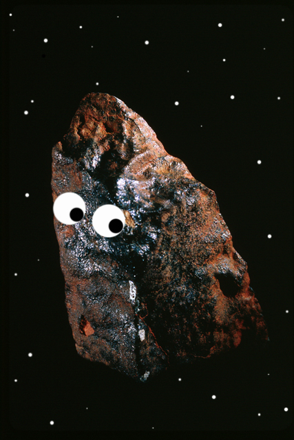
Spooky Deskcrop - Accretionary Wedge #28

What I find really spooky about this particular sample is that it has a story to tell, recorded in that big black mark. It's suspiciously femur-shaped.
 |
| Femur figure courtesy of Gray's Anatomy, via Wikimedia Commons. |

When this pumice flow lobe came into contact with the vegetation in this area, it was hot enough to scorch it, and in a lot of cases the pumice clasts are still resting on the tree limbs they burned. This particular piece of pumice records the shape of one of those limbs.The scorch mark itself is pretty cool - it's sooty from the carbonized wood, but it also has little patches of remelted glass.


Wednesday, October 27, 2010
Geological Frightfest: The Mole People
 |
| http://upload.wikimedia.org/wikipedia/en/8/8e/Mole_People.jpg |
"The film begins with a narration by Dr. Frank Baxter, an English professor at the University of Southern California, explaining the premise of the movie and its basis in reality. He briefly discusses the hollow earth theories of John Symmes and Cyrus Teed among others, and says that the movie is a fictionalized representation of this unorthodox point-of-view.
"In this movie, archaeologists Dr. Roger Bentley and Dr. Jud Bellamin stumble upon a race of Sumerian albinos living deep under the Earth. They keep mutant humanoid mole men as their slaves to harvest mushrooms, their primary food source, since they can grow without sunlight. The Sumerian albinos' ancestors moved into the subterranean after the cataclysmic floods in ancient Mesopotamia."
The mention of the "Hollow Earth" idea was what caught my eye. In college, I took a freshman seminar called "Applied Pseudoscience", where we discussed logical fallacies and pseudoscience topics like this theory; our textbook was the venerable Fads and Fallacies in the Name of Science by Martin Gardner (1952), and that's where I turn whenever hollow Earth ideas get mentioned. Captain John Cleves Symmes first came up with the idea of a hollow Earth in 1818, when he suggested that the Earth was made up of five concentric spheres, both sides of which sustained plant and animal life, with huge openings at the poles. (He campaigned for years trying to get the U.S. Congress to fund an expedition to the North Pole, without success, and died in 1829 from the strain of constant campaigning.) Cyrus Reed Teed, another 19th century American, tried to advance an even more bizarre idea - that we were living on the inside of a hollow sphere, with the sun, moon, planets and stars inside the hollow and nothingness outside. (According to this idea, the internal sun is half light and half dark and rotates, thus producing day and night. If you think the sun is a light bulb, that sort of makes sense; it's when he starts talking about planets as "spheres of substance aggregated through the impact of afferent and efferent fluxions of essence" that I get lost.)
The idea had been mentioned even earlier than the 19th century, however. Edmund Halley published an essay in 1692 describing an Earth with a shell 500 miles thick, two inner shells the size of Mars and Venus, and a solid inner sphere the size of Mercury (all of which should be capable of bearing life). A particularly brilliant display of the aurora in 1716 prompted him to suggest that the lights were caused by glowing gas escaping from thin spots in the outer sphere at the poles. Doubtless there were many people before Halley who came up with similar ideas, perhaps related to the idea of an underworld - although they probably never came up with something as odd as mushroom-harvesting mutant mole men!
PS - It looks like you can read a pretty good chunk of Fads and Fallacies via Google Books, and I highly recommend it; it's a pretty funny book and covers a lot of pseudoscientific topics, although it can get a bit dense in parts.
Tuesday, October 26, 2010
Geological Frightfest: Jurassic Park
 |
| http://upload.wikimedia.org/wikipedia/en/e/e7/Jurassic_Park_poster.jpg |
Monday, October 25, 2010
Geological Frightfest: Tremors
 |
| http://en.wikipedia.org/wiki/File:Tremorsposter.jpg |
Sunday, October 24, 2010
A few more tweaks until the new location is ready...
Wednesday, October 13, 2010
Reflecting on Earth science perceptions
It's Earth Science Week again - this time with an energetic twist. Volcanology and energy are certainly linked in the geothermal realm, but I'm going to skip that discussion and discuss an article I found recently. It's called "United States earth sciences, status, and future: How bad, how good?"
 The article takes a step back from the process of doing earth science and looks at its situation as a whole, and what we can (and should) be doing to help improve the public's perception of our field. (That's what Earth Science Week is all about - good outreach! - so I think it's definitely a relevant topic for a post this week.)
I'll start you off with a quote:
I'll start you off with a quote:
"In terms of public perception, however, earth scientists appear to come off rather badly, in spite of the fact that the nature of the Earth and the societal importance of mineral and energy resources, geologic hazards, and biological evolution are familiar concepts to the public. Everyone 'knows' what a physicist, chemist, or mathematician does (really?), possibly because the subjects are universally offered in secondary schools. Astronomy, however, seems to be more recognizable to the lay public than is geology, in spite of the more abstruse nature of the former, and neither science is generally taught in high school. Perhaps another reason for the lack of familiarity with geology stems from its remarkable diversity. Our field is almost unique among the sciences in being dependent on, and a blend of, all of the primary sciences and many purely geologic specializations as well."
This is certainly true. Considering that things like fossil fuels, climate change, earthquakes, eruptions, tsunamis, and the like are in the news almost every day, it's amazing to see how little people seem to know about the science behind the topics. A lot of the news seems to be about earth scientists dealing with ignorance about the process, implications and impacts of their work (like the Italian seismologists who were charged with manslaughter for not predicting the Aquila earthquake, or the climate scientist at the University of Virginia who's being hounded by the state attorney general, or the government trying to keep petroleum geologists from talking about the worst case scenarios of the BP oil spill). And I think it stems from a basic lack of understanding of Earth science, as the quote describes.
Know the interesting thing about this article? It was an address by W.G. Ernst, a retiring President of the Geological Society of America...and it was given in 1986.
The same problems we have with public perceptions of Earth science today were happening almost a quarter of a century ago. Almost before I was born, in fact. So why are we still dealing with this lack of comprehension of and respect for the Earth sciences? Shouldn't we have managed to open the public's eyes to the wonders of our field by now?
There's no simple answer to those questions. We are always in the process of trying to do improve the public's perception of Earth science - through outlets like Earth Science Week, and blogging, and outreach from professional organizations. But there also seems to be a problem with getting people involved in Earth science from the start. On the whole, it's simply not seen as an integral part of K-12 science curricula. As of 2007, there were only two states (Kentucky and North Carolina) that require an Earth science to graduate from high school, and fewer than a dozen others that integrate it into required courses. This means that a student's only exposure to the Earth sciences might come at the college level, and quite possibly as a course taken only to fulfill a science requirement. One of the American Geological Institute's Geoscience Workforce studies indicated that incoming college students perceived geology majors to be low in prestige, low in difficulty, and low-paying relative to majors like physics, chemistry, and biology. Those students didn't have a very good view of Earth science before they even had a chance to experience it. Consequently, they go on into their adult lives without a good working knowledge of the world around them, and no real way to evaluate the validity and value of what they later hear through mainstream media.
It's not all gloom and doom. Federal funding for Earth science research has more than doubled since 1986, and geoscience enrollments increased 8% in the 2008-2009 school year (a jump attributed to increased interest in energy and environmental issues). Salaries for Earth scientists have been increasing steadily for the past decade. There's a lot to find attractive about Earth science - but we need to keep selling it! Which brings me back to outreach of any kind. We as Earth scientists (and Earth science enthusiasts) need to keep telling everyone that yes, we are real scientists who do important, useful work. We work hard to get our degrees, and earn educations that are unparalleled in their breadth and depth of study. And we have fun doing it! Earth science is fascinating, and whether it's by trying to attract new grad students to your department, or get elementary school kids excited about rocks, or show off for thousands of people at a science expo, it's immensely important to never stop supporting our science. So however you do it, get out there and fulfill the spirit of Earth Science Week!
References:
Ernst, W.G. (1987). United States earth sciences, status and future: How bad, how good? Geological Society of America Bulletin, 99 (1)
A whole bunch of news
 I've been neglecting my posting lately because of our department move, but here's a little housecleaning (and there'll be a real post later today):
It's Earth Science Week! This year's theme is "Exploring Energy", and there's a lot going on - maybe even something in your area, which you can check on the "Events In Your Area" page. There are also contests to enter (including a photography contest that's open to anyone).
Wednesday, October 6, 2010
Another update & contacting info
I know, silence on the blog is boring...
My department is in the middle of moving to another building, so I'm probably not going to be blogging until next week. And the move for the blog is still in the works, so hang in there! I'll be back to normal operations soon.
And, just a brief note for folks who've been contacting me lately:
Thanks for writing! I love getting messages, especially if I can help you out with a geological conundrum. I would appreciate it, though, if you would try to send them to me at the email address listed in my contact info (magmacumlaude at gmail dot com). Messages left in the comments don't come to my attention as quickly, and I'd rather keep comments related to the post that they're associated with. (Questions via Twitter are fine, as long as they're short or include an email that I can write back to.)
Thanks bunches!
*PS* I noticed that Blogger didn't seem to be displaying my email properly for some reason. Sorry if it wasn't available! I've fixed it and it should show up on my profile now.
*PS* I noticed that Blogger didn't seem to be displaying my email properly for some reason. Sorry if it wasn't available! I've fixed it and it should show up on my profile now.
Wednesday, September 29, 2010
Guess this means it's columnar jointing week
Well, since everyone else is getting in on the columnar jointing meme/festival/whatever, I suppose I could throw a few photos out there...

Some of the oldest volcanics in the Vulsini volcanic district, Italy: a jointed trachyte from the Bolsena caldera complex. (The tree at the top of the cliff is about 3 m tall.) This is one of my favorite photos, because you can see multiple cooling sets divided by fractures - and it really emphasizes how columns form from inward-directed cooling.

Willow Mountain, Terlingua, Texas (near Big Bend). Beautiful columnar jointing throughout. (No scale on this one, but I'd say it's about 200 meters from top to base.)

And, finally, an actual example of columnar jointing in basalt, which is probably much more common than jointing in an any of the other stuff I've mentioned: a lava flow near St. George, Utah. (Wish I could figure out where, but Google Earth isn't helping today. Has anyone seen this abandoned water tank?)

Columns in an ignimbrite on the east side of Santa Maria volcano in Guatemala. (A drive-by, unfortunately. I would have loved a close-up look at these!)

Some of the oldest volcanics in the Vulsini volcanic district, Italy: a jointed trachyte from the Bolsena caldera complex. (The tree at the top of the cliff is about 3 m tall.) This is one of my favorite photos, because you can see multiple cooling sets divided by fractures - and it really emphasizes how columns form from inward-directed cooling.


And, finally, an actual example of columnar jointing in basalt, which is probably much more common than jointing in an any of the other stuff I've mentioned: a lava flow near St. George, Utah. (Wish I could figure out where, but Google Earth isn't helping today. Has anyone seen this abandoned water tank?)

Perhaps we should submit a request for a Columnar Jointing Week to someone in Washington. As far as I can tell, we're sadly lacking in geological observances anyway...
Tuesday, September 28, 2010
Upcoming changes
Magma Cum Laude will be moving to a new location soon - more details on that when it happens! In the meantime, posting will go on here (and I'll try and cross-post if I can). Stand by for new developments...
Monday, September 27, 2010
"If we knew what we were doing, it wouldn't be called research"

If I'm remembering correctly, this was our first real mapping assignment. I, having had no classes in mineralogy, petrology, structure, or mapping, was working with some of the older students. At this point, I'd managed to pick up basic Brunton skills and was reasonably certain I could tell sandstone from limestone. I was still pretty nervous about the assignment, since at that point I was still a bit of a perfectionist (left over from high school, I guess).
We spent the entire day climbing over rocks, gazing at outcrops from high spots, breaking off hand samples, squinting through our hand lenses. And by the end of the day, we still hadn't managed to cover the whole area. I was excited when we found what I guessed was volcanic ash right next to a pretty obvious fault, but mainly because I could actually stand on the thing and say "this is a fault". Beyond that, I was definitely having trouble putting lines and color on our map. Looking back at my field notes, I know I didn't get as detailed as I could have, mostly because I didn't really know what was important to write down. I felt like I should have been able to figure out field relations and rock types by that point on the trip.
I was completely frustrated with myself and the assignment by the end of the day, especially when it became apparent that we'd neglected to investigate a few of the units properly and left one completely off the map. Once we'd turned in our assignments, however, and were sitting around the campfire toasting food and joking, I realized something important: that I had expected myself to come up with all the answers even when I was still developing the tools I needed to find them. There was no way I was going to complete the assignment perfectly. And that was okay, because I was still learning. And that's something I've had to remind myself of all the time, especially when I get frustrated or upset over something: I'm still learning. I'll still be learning when it's time to retire - and I'll still be learning after that.
As a freshman, I may have been bright enough that my advisor invited me to come on a trip that was normally restricted to upperclassmen, but I should also have been bright enough to realize my own limitations. That was one of the best things I learned on that trip, and one that's helped me immensely since. If I can take a step back from whatever frustrating problem I'm dealing with at the moment, I can figure out what I tools and knowledge I need to acquire to solve it. That process may be slow and frustrating itself, but it's much better than thinking I know everything (and then finding out, usually in embarrassing ways, that I'm wrong). Come to think of it, this is a great way to look at life in general, not just geology.
As a freshman, I may have been bright enough that my advisor invited me to come on a trip that was normally restricted to upperclassmen, but I should also have been bright enough to realize my own limitations. That was one of the best things I learned on that trip, and one that's helped me immensely since. If I can take a step back from whatever frustrating problem I'm dealing with at the moment, I can figure out what I tools and knowledge I need to acquire to solve it. That process may be slow and frustrating itself, but it's much better than thinking I know everything (and then finding out, usually in embarrassing ways, that I'm wrong). Come to think of it, this is a great way to look at life in general, not just geology.
Monday, September 20, 2010
Distinguishing deposits from andesitic eruptions
Telling apart different kinds of deposits associated with volcanic eruptions isn't always easy. There are a lot of factors that can affect their appearance: the location and type of eruption, the magma/lava type, where they're emplaced, etc. On Montserrat, volcanologists are lucky to have both ancient and modern deposits; they can look at what's currently being erupted and compare it to the older volcanics on the island. We did quite a bit of this on our field trip, and one of our assignments was to summarize the characteristics of andesitic eruption deposits on Montserrat. (I emphasized that because the characteristics we saw are not necessarily going to be the same for all volcanic eruptions, or even for all andesitic eruptions. I've tried to generalize a bit, but apply these cautiously if you're going into the field to look at other volcanic deposits; things may look very different in your field area.)
Block and ash flows are a kind of pyroclastic density current. "Pyroclastic flow" is a kind of catchall term, but there are more specific ones that better describe the makeup of one of these currents. "Block and ash flow" implies that the flow is composed of blocks (either of denser lava or pumice or both) and ash; "pumice flow" means that the contents are mainly pumice and ash, "ash flow" that there are few blocks and mostly ash in the current.
Block and ash flows contain a range of clast sizes from mm-sized ash to m-scale boulders. The clasts are usually somewhat angular and tend to be a combination of lithics (lava) and pumice. The matrix of these deposits (what larger clasts are embedded in) is generally ashy and may be crystal-rich. The deposit may be clast or matrix supported (which describes whether there is enough matrix that the clasts are not touching) and poorly sorted (clasts are not separated by size). Oxidation and alteration of clasts as well as fractured blocks (including radially jointed clasts) may occur if the flow is deposited into water and cools quickly. Sometimes you can see grading in the deposits (i.e., a change from small to large clasts, or the reverse), which has to do with the energy of the pyroclastic current and the conditions under which clasts are being deposited from it.
Clasts in a lahar deposit range from mm to multi-meter size. They are matrix supported, poorly sorted, and often contain clay or silt in the matrix. The clast shapes vary from rounded to angular and may be either monolithologic (all one rock type) or mixed rock types, depending on the source material. Sometimes the deposits show bedding features such as cross-bedding. There is one absolutely diagnostic feature for lahars: preserved voids where bubbles of air were trapped in the matrix mud. The voids are spherical and usually pretty tiny, but they don't form in pyroclastic currents. (The lack of these voids does not, however, mean that a deposit is not a lahar, so this feature is only useful if it's present.)
Block and ash flows are a kind of pyroclastic density current. "Pyroclastic flow" is a kind of catchall term, but there are more specific ones that better describe the makeup of one of these currents. "Block and ash flow" implies that the flow is composed of blocks (either of denser lava or pumice or both) and ash; "pumice flow" means that the contents are mainly pumice and ash, "ash flow" that there are few blocks and mostly ash in the current.
 |
| Faint reverse grading in a block and ash flow deposit at Old Road Bay |
 |
| Pointing out matrix in a deposit on the side of the Belham River Valley |
Debris avalanches form from older volcanic material that's unstable enough to collapse, either because of erosion or alteration or both. They form "hummocky" deposits that are very obvious in aerial photos, but in cross section they're also fairly easy to identify.
Lahars form when water mixes with volcanic material and flows downslope. These can have the consistency of soup to concrete, and they're a major concern even when a volcano isn't erupting (especially if the volcano is located in a tropical area that gets lots of rain.)
 |
| Panorama of a debris avalanche deposit near Jack Boy Hill. Different colors mark chunks of preserved stratigraphy. |
Debris avalanche deposits contain mm to m sized clasts (or larger), as well as chunks of material from older deposits that retain their original stratigraphy. These clasts and chunks are poorly sorted, and rounded to angular in shape. Clast compositions are almost always mixed, and the matrix is often clayey and highly altered. Jigsaw jointing is apparent in individual clasts, with clast fragments separated by matrix material but orientation with respect to neighboring clasts preserved. Clasts or deposit blocks may be "smeared" out into trains or show internal faulting.
 |
| A "jigsaw" fractured block in a debris avalanche deposit |
 |
| House buried in lahar deposits in the Belham River Valley |
 |
| Cross-section of a fairly recent lahar deposit. There's not much in the way of sorting or grading here. |
A fourth type of pyroclastic current, called a surge, also shows up on Montserrat, but they're not often preserved because they consist of a blast of ash and hot gases (sometimes derived from block and ash flows), and they leave very thin deposits. I don't have any good photos of them, but they tend to be fine-grained (mm to cm sized clasts at the most), and sometimes show cross-stratification. It's rare that they're preserved, especially in a tropical environment, because the fine material washes away very easily.
Tuesday, September 14, 2010
A question of time
*Note: Having been temporarily flattened by my yearly fall cold, I'm putting up a non-geology post that I was working on earlier this month and have just enough energy to finish now. I'll make it back to talking about andesitic eruption deposits just as soon as I emerge from the haze of cold drugs.
'Tis the season for the arrival of new grad students (geology and otherwise), and 'tis also time to talk about time. As in, time management - possibly one of the most important skills a grad can have (or develop).

'Tis the season for the arrival of new grad students (geology and otherwise), and 'tis also time to talk about time. As in, time management - possibly one of the most important skills a grad can have (or develop).
You've heard it a lot of other places, but I'll repeat it here as well: Graduate school isn't like undergraduate, unless you were part of a crazy tough undergrad department. You're much more responsible for yourself, including how you portion out your time between classes, research, work (if you happen to be a TA), and downtime. I treat it as a job, because that's what it should be. And it's really, really important to know how much time to devote to the different parts of your job - and when to take a break.
Classes will be important, but unlike undergrad, they're not the biggest part of your life. Most grad programs will expect you to maintain a certain GPA of to remain in the program, but you shouldn't be working yourself to death over your classes. Eventually, you won't be taking as many (or any at all), and if you're not used to working on things other than classwork, it will be harder to adjust. Pace yourself if you can - sometimes you can put off a class that's not essential to your research.
Likewise, if you're TAing, remember that the teaching experience is useful - and if you plan to be a professor someday, it may be some of your only training - but that research is your primary mission. Put in the work that you need to, but don't get sucked into agonizing over grading or class preparation. Ask for help if you need it, from your professor or the other TAs. Don't get too emotionally invested in it; not every student is going to like you or your teaching style (or their grades).
Research should be the main focus of your time in grad school. Even if you don't have a solid idea of what you want to work on when you come in, start by doing as much reading as possible (without frying your brain). Use your class projects to help develop (and answer!) research questions. Set daily, weekly and monthly goals for yourself, and keep track of things like conference deadlines and committee meeting dates (they're good things to schedule your work around). If you have an idea for a research proposal, start writing whatever you can, a little bit at a time - it will save you a lot of work come crunch time. Keep a calendar (or two) to remind you of your appointments; being able to look ahead at a deadline will help you plan out your time better.
And most importantly, remember to take time for your own well-being. It's really, really easy to get overstressed in grad school. Between teaching, research, writing, taking classes, and dealing with everyday life, you're going to be really busy. You may well be putting in longer hours than a regular job, just to get things done - and that's okay. But make sure that you take time off for yourself, because your mental health is just as important as your degree. I feel like I came from a rigorous academic background, and I still had rough patches getting adjusted to grad school; everyone does. But I learned that I had to step away from it and do fun things for myself - hiking, shopping, going out with friends, watching cheesy horror movies, blogging, etc. It's made the whole experience a lot more enjoyable, and I think that even though grad school is difficult, if you're not enjoying it on some level, there's something that needs to change.
Wednesday, September 8, 2010
February 2010 dome collapse deposits at Soufriere Hills
If you ever want to visit a post-apocalyptic wasteland, someplace that's been run over by pyroclastic flows would be a great choice. On February 11 of this year, a partial dome collapse on the northeastern flank of the Soufriere Hills lava dome produced spectacular pyroclastic flows, surges, and a 50,000 ft (~15 km) high ash plume. The pyroclastic flows extended the eastern coastline significantly in the area of the old Bramble Airport, and surges were observed flowing out over the ocean on the eastern side of the island.
Here's a photo from the edge of the collapse deposits, below the Jack Boy Hill overlook. In the distance of this photo, you can (just) see a chimney stack. This is one of the only visible structures left in the whole area; even the old Bramble Airport (which would have been visible to the left of the chimney) is now completely buried.

The chimney stack is part of an old sugar mill, and I'm pretty sure that what's visible isn't the whole chimney. To give you a sense of scale, here's yours truly standing next to the stack.

Walking on pyroclastic deposits isn't difficult, but it's not the most pleasant hike I've taken. Ash is nasty stuff, especially when you're kicking it up whenever you walk somewhere. In addition, these deposits are still(!) quite hot; a few inches down is enough to make it uncomfortable to stand in one place too long, and digging less than a foot down, they become hot to the touch.

Here's what the deposits look like in cross-section. Those dark streaks are degassing structures, which are cut off by the most recent deposits on the top of the sections.

As I mentioned before, the Montserrat Volcano Observatory scientists brought us on this hike; in the khaki hat and olive shirt is Dr. Paul Cole, the Director of the Observatory. We're examining one of the boulders that was transported downslope in the collapse - and while it looks pretty big, it's actually one of the smaller boulders that we saw. The largest were the size of small houses! (Definitely not something you want to get hit by, which is why it's a good thing that the people on Montserrat pay attention to the exclusion zones.)

On several of the boulders, we saw examples of marks that are interpreted to have been created by the impact and scraping of one boulder against another during transport. They could be described as slickensides, except here they're glassy surfaces that were created very quickly during an impact, rather than slowly during the scraping of a fault surface. (The study I linked to mentions that in the largest marks, frictional melting formed pseudotachylite, which is basically glass.)

Things like the friction marks above, and this next photo, remind you of just how dangerous pyroclastic flows are. Aside from giant boulders smashing into each other, you also get stronger-than-hurricane-force blasts, poisonous gases and extremely high temperatures. To give you an idea of what that does to the landscape, here's a view of the end of a pumice flow lobe that carried trees with it. All the wood here is carbonized; my best guess is that temperatures of around 400°C (or higher!) were involved. That's about twice as hot as your kitchen oven will go.
Did I mention the force involved in pyroclastic flows? Here's an example: a tree limb thicker than my arm that was snapped in half and then pretty much welded into that position.

Another interesting feature just beyond the pumice lobe were these pit craters, formed when the flow buried a water source, which was then heated to steam and exploded up through the new material.

I think the water in question was probably part of this drainage (this is looking roughly to the west), which we walked down on our way back to the vehicles. While these deposits do retain their heat, there doesn't seem to be enough time to really weld them together, so they're pretty easily washed away by precipitation, and form these sorts of drainage channels.

The channels do make it much easier to see cross-sections, though! There are at least five (probably more) different deposition events represented here, with a lovely pumice-filled channel right in the middle.

I'll try to get to a post on how to distinguish different types of deposits next (and hey, maybe some annotated photos!)
UPDATE: Claire Howard (one awesome reader) sent in some photos of the factory chimney at Trants from May 1995, 6 months before the beginning of the eruption. Turns out that chimney was a lot taller than it is now. Enjoy - and thanks to Claire!


Friday, August 27, 2010
Montserrat and the Soufriere Hills volcano
This summer I was lucky enough to take an absolutely amazing field trip on the island of Montserrat, where my advisor spent two weeks showing us around her old stomping grounds. And let me tell you, I would have no problem doing volcanology on a Caribbean island for a while...
Montserrat is part of the Lesser Antilles volcanic arc, which is formed by the subduction of the Atlantic tectonic plate below the Caribbean plate. Most of the islands in the arc have andesitic volcanoes, which tend to produce explosive eruptions and lava domes. Montserrat itself is composed of three different volcanic centers: the Silver Hills in the north (the oldest, where the rocks date to ~11-25 million years), the Centre Hills in the center (9.5 - 5.5 million years), and the Soufriere / South Soufriere Hills in the south (at least 1.7 million years to the present). (For more information on the argon-argon dates that produced these ages, see the Harford et al. reference below.)
The island is very densely vegetated, with most towns clustered around the coast; this also means that the best (old) rock exposures are in sea cliffs. (Hence we spent a lot of mapping time on beaches. Not a bad deal, eh?)
When seismic activity (namely earthquake swarms) started happening in 1992, the island was still trying to recover from the damage caused by Hurricane Hugo in 1989. In 1995, phreatic explosions (involving heated groundwater, but no lava eruption) began opening vents in English's Crater. Ash from larger explosions prompted the evacuation of southern Montserrat in August of 1995, and by November a lava dome began growing in the crater. Since then there have been a number of periods of dome growth and collapse, during which the volcano has built the original lava dome into a large edifice that completely covers the old crater. Dome growth has been accompanied by pyroclastic flows, lahars, and ash venting; occasional periods of explosive eruptions and phreatic activity have occurred.
Dome collapses at Montserrat are impressive, often accompanied by explosions, and can involve anywhere from tens of thousands to millions of cubic meters of material. The most recent occurred in February of this year; you can see video (thermal and normal) at the Montserrat Volcano Observatory website, and I'll be showing photos of our field trip to the collapse deposits in a later post.
We had the opportunity to spend some time at the Montserrat Volcano Observatory, where the scientists graciously spend time showing us the ropes (and taking us on some great field trips).
In return, we gave lunchtime presentations on subjects relevant to andesitic dome eruptions, and helped map some of the older deposits on the west side of the island. In Smith et al. (2007) - mentioned above - the authors mapped cliffs on the east (old airport) side, but presumably got distracted by the new eruption before they could get to the rest of the island. As part of our class requirement (yes, we got credit for this trip!), we did a survey of sea cliffs on the west side of the island, which meant many long and grueling hours spent on beaches and in boats.
It was a fantastic trip, with great opportunities for seeing old and new products of explosive volcanism (sometimes side by side). The staff at the MVO were very gracious, as was everyone we met on the island. (Perhaps the only downside of the trip was the state of my legs after two weeks of being munched on by tropical mosquitoes; apparently I'm tastier than the majority of the folks who went on the trip.) More discussion to come of the February 2010 collapse, the older volcanics, and how to distinguish different kinds of deposits!
Montserrat is a beautiful island, but it's small - and the fact that the Soufriere Hills volcano has made a bit more than half of it unlivable hasn't helped any. Here's a basic map of the island, with the approximate boundaries of the exclusion zone (which changes depending on activity):
 |
| From http://travel.state.gov/travel/cis_pa_tw/cis/cis_974.html |
 |
| Maps of the Antilles arc and the volcanic centers on Montserrat. From Smith et al. (2007), Prehistoric Stratigraphy of the Soufriere Hills–South Soufriere Hills Volcanic Complex, Montserrat, West Indies. |
 |
| Montserrat from the north, with the Silver Hills in the foreground and the Centre Hills just visible below the clouds. |
 |
| The current lava dome viewed from Jack Boy Hill (east side of the island), with a large collapse scar visible to the right. Because this is a tropical island, it's pretty unusual to see the dome this clearly, so we got lucky. (The same thing happens in Central America - my field area is frequently clouded in.) |
 |
| Looking at the west side of Soufriere Hills. The light gray slope on the left marks a point where pyroclastic flows and dome collapses have filled in old topography, as well as burying the former capital of Plymouth. The bluish cloud hanging over the volcano is a steam and gas plume, which gets its bluish tint from sulfur gases. |
 |
| Another Jack Boy Hill view, this time of the February 2010 collapse deposits. This is the site of the old Bramble Airport, and it's been run over by various other pyroclastic flows in the past, but until February the old airport and some structures were still visible. Not anymore! |
 |
| The Montserrat Volcano Observatory perched above the Belham Valley. Swanky! |
 |
| Examining friction marks on a boulder in the February 2010 deposits. |
 |
| As field locations go, you really can't beat one that's steps away from the beach (and the beach bar). |
 |
| How could anyone work in these conditions? |
References
Harford, C.L., Pringle, M.S., Sparks, R.S.J., Young, S.R., 2002, The volcanic evolution of Montserrat using 40Ar/39Ar geochronology. In The Eruption of Soufriere Hills Volcano, Montserrat, from 1995-1999 (T.H. Druitt and B.P. Kokelaar, eds.), p. 93-113.
Smith, A.L., Roobol, M.J., Schellekens, J.H., Mattioli, G.S., 2007, Prehistoric Stratigraphy of the Soufriere Hills-South Soufriere Hills Volcanic Complex, Montserrat, West Indies. The Journal of Geology, v. 115, p.115-127.
Subscribe to:
Posts (Atom)


